PRESTON COUNTY WEST VIRGINIA LAND FOR SALE!
Property Description:
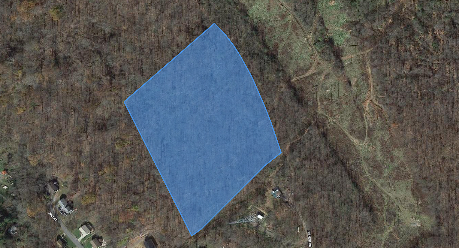
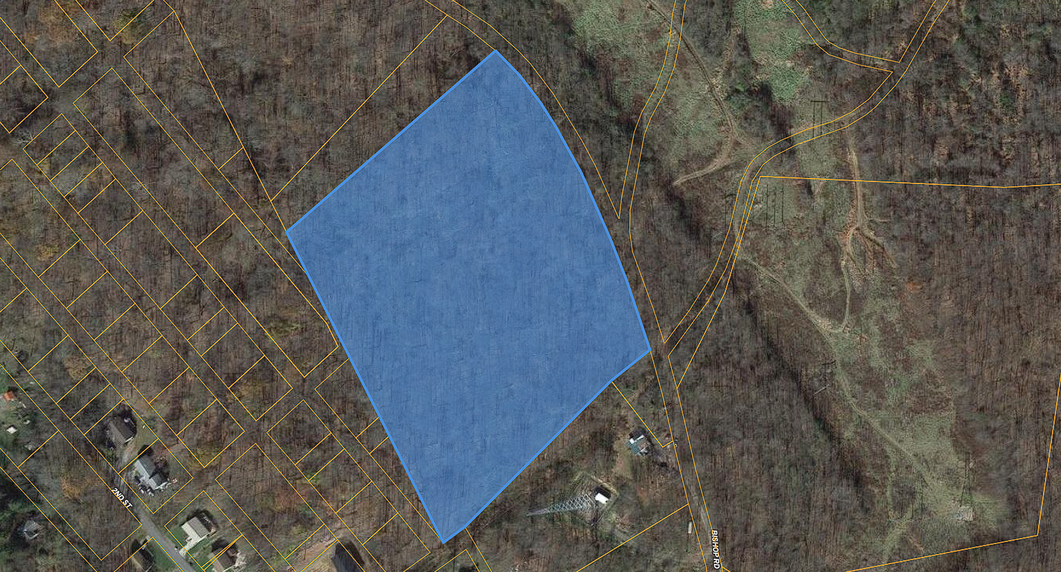
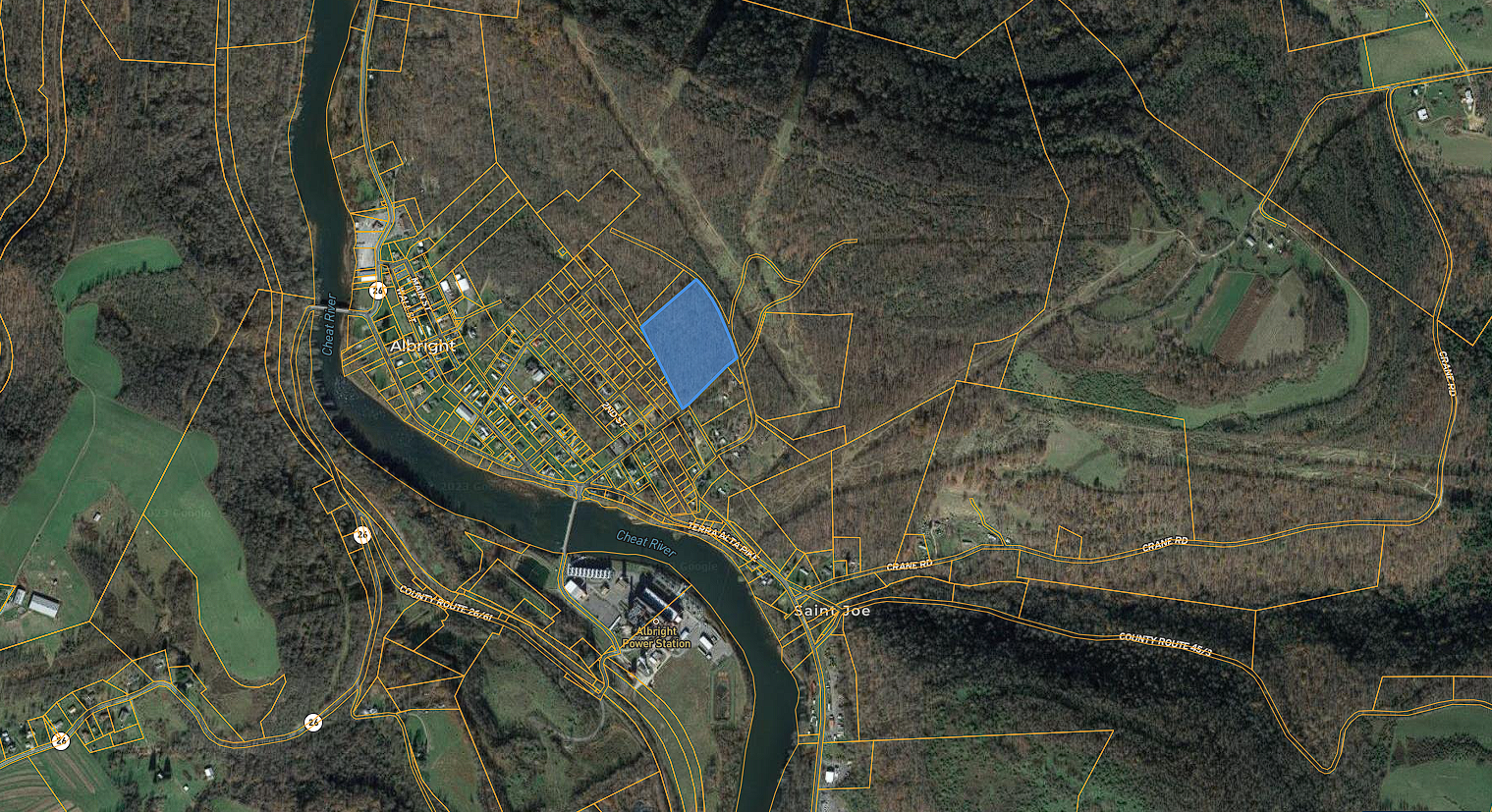
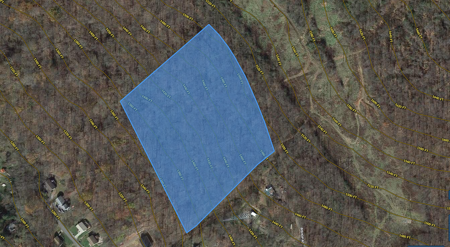
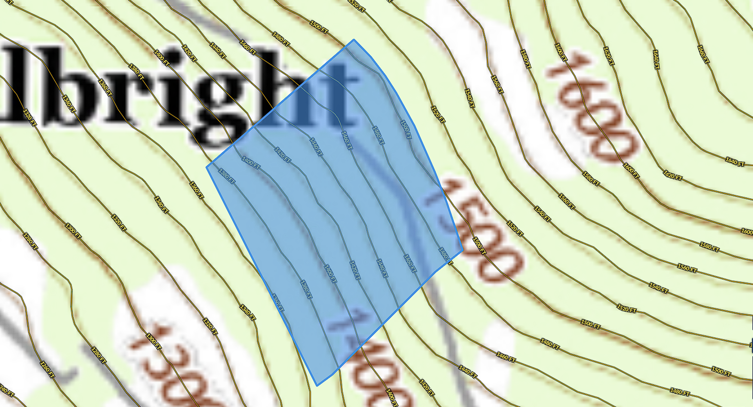
5.86 acre lot in a park like setting, tucked away just north of the cheat river and allegheny trail trailhead. This property is not in a flood zone as it is higher up on the hill allowing you a scenic and unobstructed view of the river. If you choose to build, the property has a sloping elevation from the south corner to the north corner.
If you know anything about WV, you know the Cheat River! Future investments here will be hugely profitable as the Cheat River becomes more and more known for its white-water rafting, kayaking, fishing, and this ideal location is a part of the Cheat Canyon 13-mile section of Cheat River that has Class V rapids during the spring, not to mention the over 30 rapids rated Class III to Class V along the river.
Property Specs:
Lot size: 6 acres +/-
Lot description: fully wooded, gently sloping
Road access: dirt road access
Land use: Vacant/Residential Acreage
Taxes: $119.66
Water: Well (needs to be installed)
Sewer: Private septic (needs to be installed)
Electric: close by (transmission lines east and south of the property)
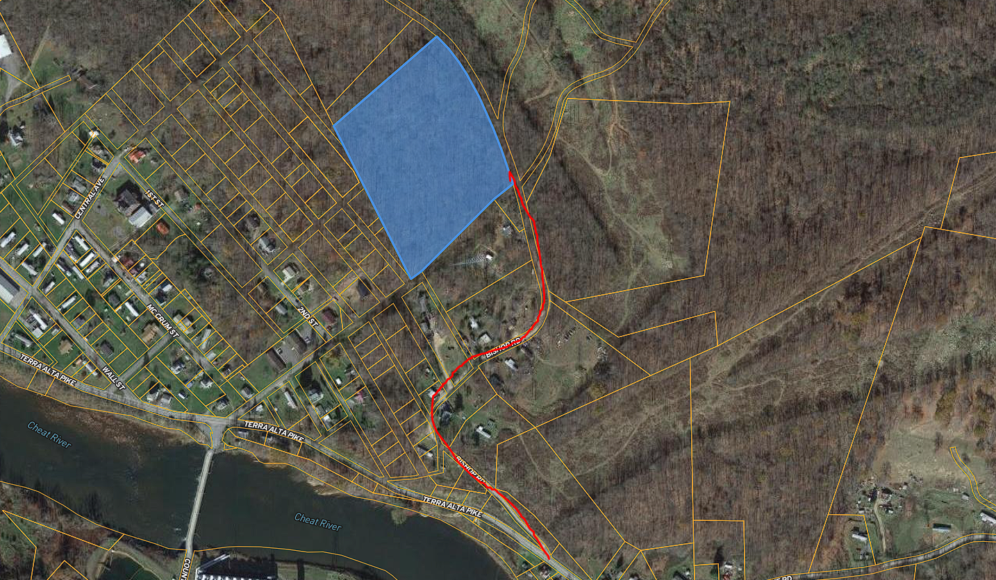
Directions to property from the North Preston Kwik Stop:
2735 N Preston Hwy #2, Albright, WV 26519
Head southwest on WV-26 S toward Metheny Ave – 0.1 mi
Turn left onto St Joe Rd – 0.7 mi
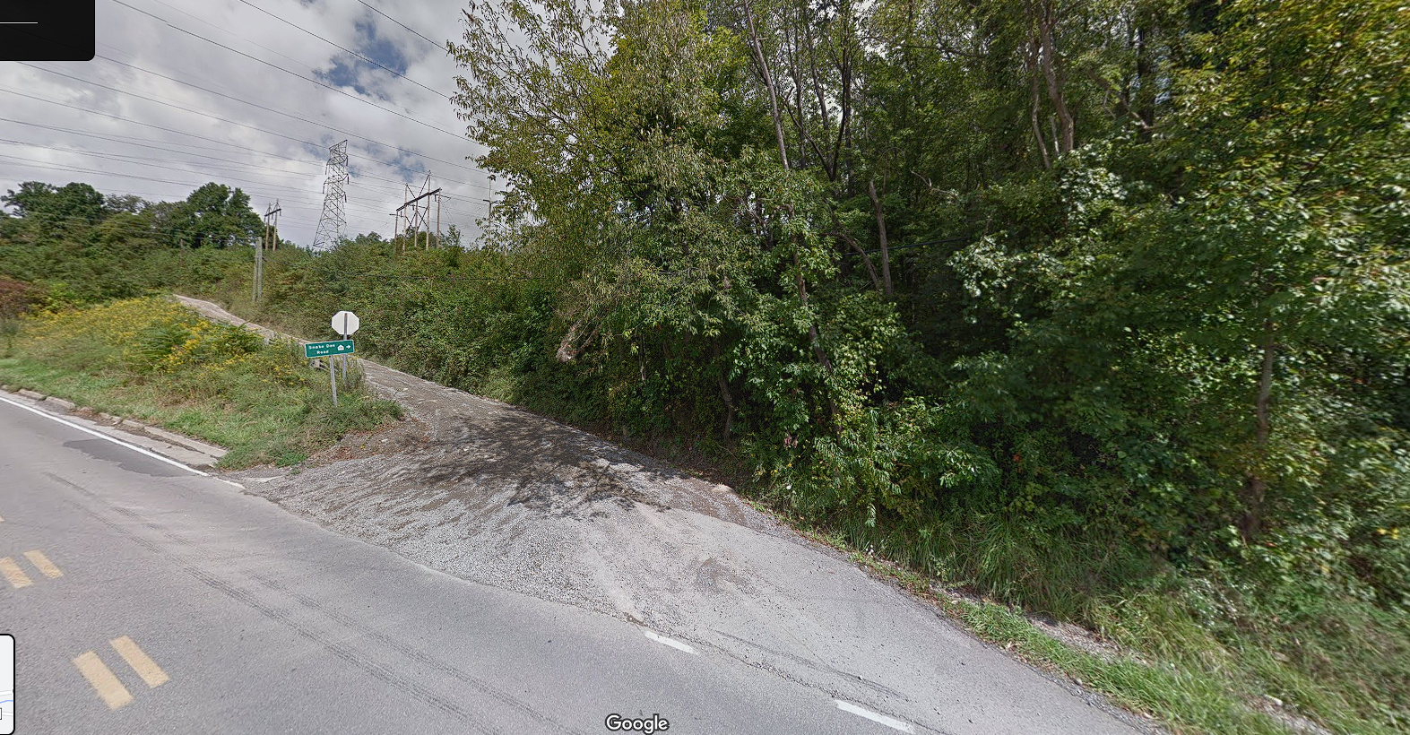
Sharp left onto Bishop Rd/Snake Den Rd – 0.3 m
Stay right on the dirt road after you pass the big radio antenna
East corner of property at gps coordinates 39.4937, -79.6347
Approx. GPS coordinates for 4 corners of property:
North corner: 39.4953, -79.6358
East corner: 39.4937, -79.6347
South corner: 39.4928, -79.6361
West corner: 39.4928, -79.6361
MOL: 39.4941, -79.6359
**Disclaimer: The information above has been obtained from sources believed reliable. While we do not doubt its accuracy we have not verified it and make no guarantee, warranty or representation about it. It is your responsibility to independently confirm its accuracy and completeness. Any projections, opinions, assumptions, boundaries or estimates used are for example only and do not represent the current or future performance of the property. You should conduct a careful, independent investigation of the property to determine to your satisfaction the suitability of the property for your needs including but not limited to building codes, restrictions, property boundaries, lot lines, total lot size and any other due diligence you as a buyer see fit. Any GPS coordinates provided are approximations ONLY! Attached for ease of location; this is not a survey or for official use!**
***Access to this parcel of land is granted strictly at the visitor’s own risk. Visitors should exercise caution while on the premises. The property owner assumes no responsibility or liability for any injuries, damages, or losses incurred by any visitor to the property. By entering the property, visitors acknowledge and accept these risks and agree to hold the property owner harmless for any liability.