Property Description:
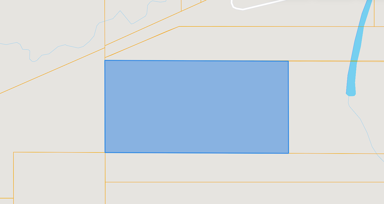
– 20+/- acres total
– Off-grid recreational land
– 10 minute drive to Wilburton
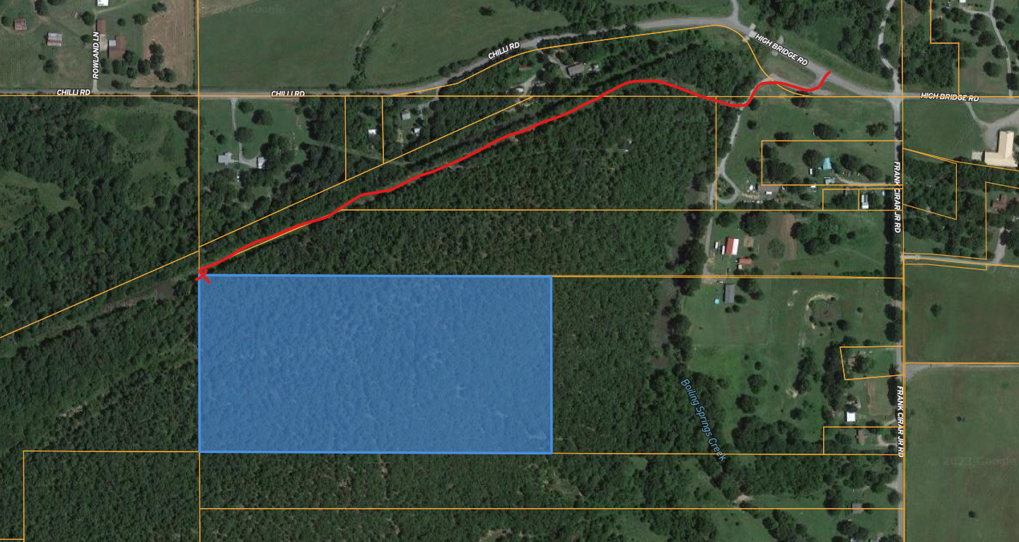
– Access via utility easement
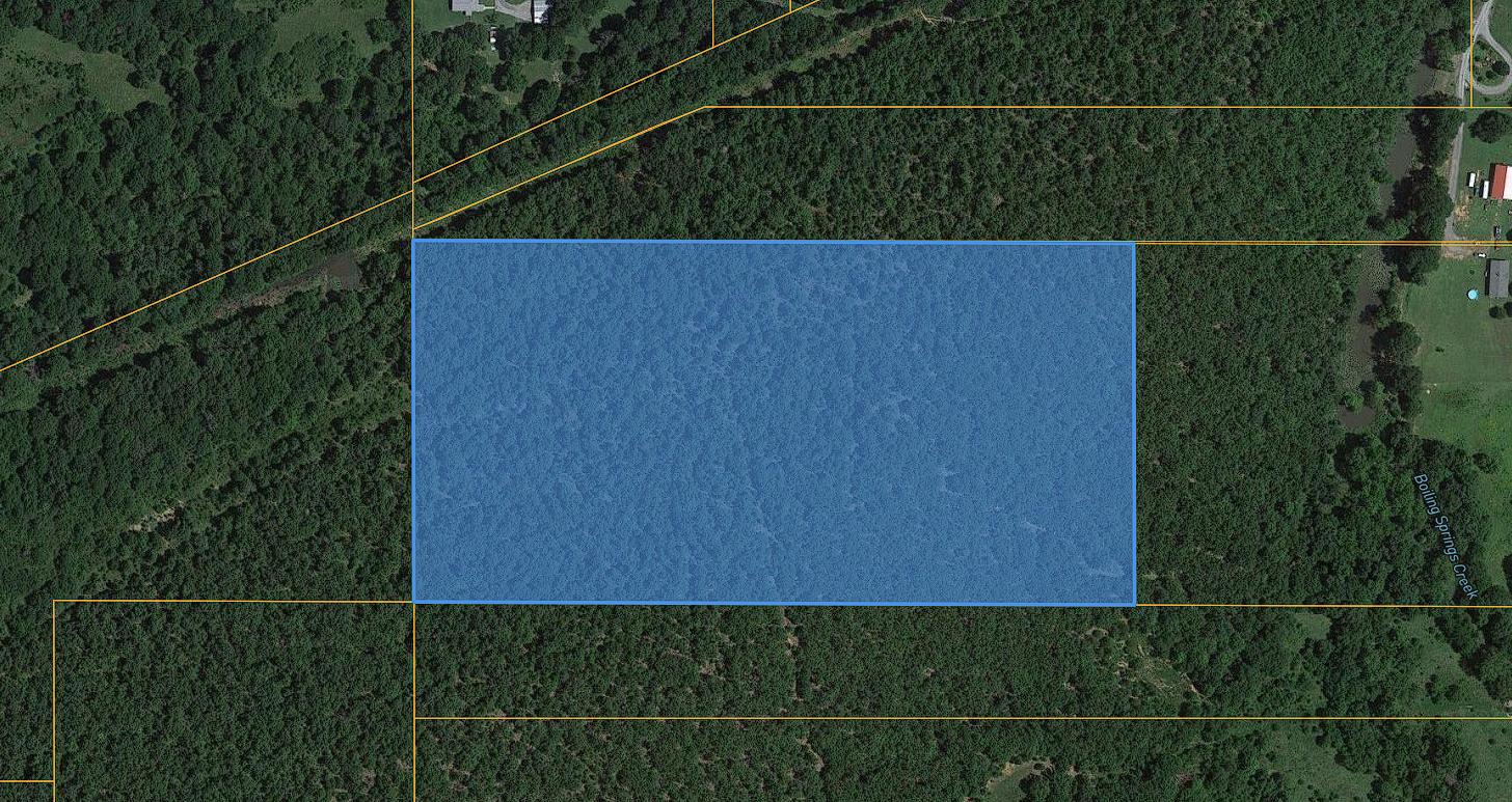
– Fully wooded
– No utilities available
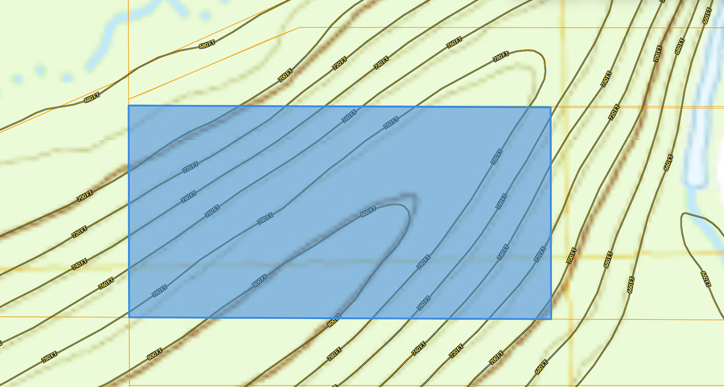
– Sloped land with nice flatter area towards the high point of the land
Property Specs:
Lot size: 20 acres +/-
Lot description: Wooded, sloped land
Road access: No road, access via utility easement
Land use: Recreational
Taxes: $9
Water: No water available
Sewer: No sewer available
Electric: Off-grid
Escape the hustle and bustle of city life and immerse yourself in the tranquility of nature on this pristine 20-acre parcel of land just minutes away from the charming town of Wilburton. Nestled in the heart of Latimer County, this fully wooded recreational haven offers the perfect blend of privacy, natural beauty, and investment potential.
Key Features:
Untouched Natural Beauty: This land is a nature lover’s dream, boasting lush, mature trees and a variety of wildlife. The picturesque landscape offers endless opportunities for hiking, camping, hunting, or simply unwinding in the great outdoors.
Diverse Topography: With sloped terrain and a flatter high point, this property offers a unique blend of elevations. The elevated area provides an ideal spot for a future cabin or retreat, affording breathtaking panoramic views of the surrounding forest.
Strategic Location: While you’ll feel a world away from it all, you’re just a short drive from the town of Wilburton. Here, you can access essentials and enjoy local amenities while still maintaining the serenity of your private oasis.
Off-Grid Living: Embrace off-grid living and self-sufficiency. This property offers the chance to create your own utilities and infrastructure, allowing you to design your dream escape on your terms.
Investment Potential:
The possibilities are endless with this 20-acre parcel. Whether you envision a future retreat, a recreational haven, or a long-term investment, this property offers a solid foundation for your dreams.
Don’t miss this opportunity to own your slice of Oklahoma wilderness.
Directions from Wilburton:
Head west on E Main St toward N Central Ave – 0.5 mi
Turn right onto OK-2 N – 1.9 mi
Turn left onto NW Highbridge Rd – 1.1 mi
Turn left to stay on NW Highbridge Rd – 4.6 mi
Turn left onto High Brg Rd
Destination will be on the right – 397 ft
Park at: 34.942047, -95.439592
*Take the utility easement back to the NW corner of the property
Approximate “4 corners” coordinates:
NE: 34.9402, -95.4419
SE: 34.9385, -95.4419
SW: 34.9385, -95.4463
NW: 34.9403, -954463
MOL: 34.9395, -95.4441
Park at: 34.942047, -95.439592
Google pin:
https://maps.app.goo.gl/VMukvFd64HvgjPLT6
Apple pin:
https://maps.apple.com/?ll=34.942014,-95.439533&q=Dropped%20Pin&t=h
**Disclaimer: The information above has been obtained from sources believed reliable. While we do not doubt its accuracy we have not verified it and make no guarantee, warranty or representation about it. It is your responsibility to independently confirm its accuracy and completeness. Any projections, opinions, assumptions, boundaries or estimates used are for example only and do not represent the current or future performance of the property. You should conduct a careful, independent investigation of the property to determine to your satisfaction the suitability of the property for your needs including but not limited to building codes, restrictions, property boundaries, lot lines, total lot size and any other due diligence you as a buyer see fit. Any GPS coordinates provided are approximations ONLY! Attached for ease of location; this is not a survey or for official use!**
***Access to this parcel of land located is granted strictly at the visitor’s own risk. Visitors should exercise caution while on the premises. The property owner assumes no responsibility or liability for any injuries, damages, or losses incurred by any visitor to the property. By entering the property, visitors acknowledge and accept these risks and agree to hold the property owner harmless for any liability.


